Gedling Country Park
Gedling Country Park, Spring Lane, Gedling, Nottinghamshire, NG4 4PE


To provide you with the best experience, cookies are used on this site. Find out more here.

To build your own Itinerary, click  to add an item to your Itinerary basket.
Already saved an Itinerary?


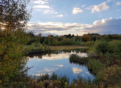

There’s lots to do on a visit to Gedling Country Park!
The children’s play area has a mining tower slide, zip wire, wheelchair accessible roundabout, mining train and more.
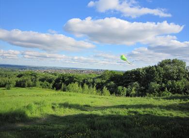
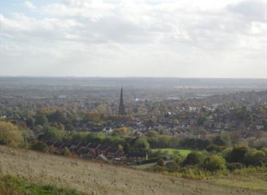
Two viewing platforms have lots to look out for on a clear day, including Belvoir Castle and Lincoln Cathedral!
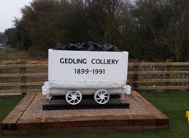
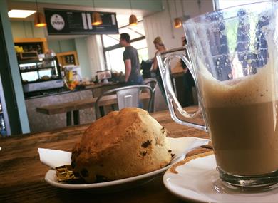
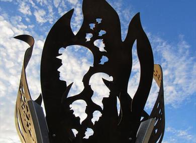
The visitor centre shows the mining history of the park and you can get delicious food and drinks at Café 1899.
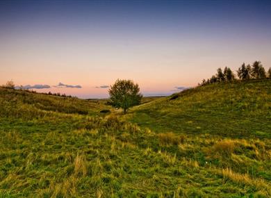
Routes of varying length and difficulty around the park include a wheelchair-friendly path.
Other things to do include:
Find out more at the website.
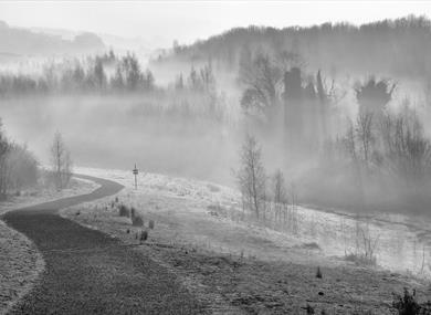
The park has several entrances including paths from nearby residential areas and is easy to access by foot, car or public transport.
| Gedling Country Park (1 Jan 2025 - 31 Dec 2025) |
|---|
* Opening times:
- Country Park: 24/7 (walking and cycling)
- Car Park: Summer 8am-9pm, Winter 8am-4pm.
- Café: Summer 9am-4pm, Winter 9am-3pm.
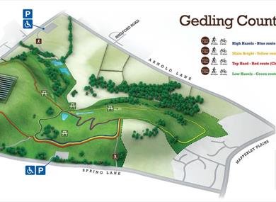
Various path routes:
- Top Hard (Red) - 2.8km long with some steep inclines.
- High Hazles (Blue) - 1.4km with gentle slopes suitable for wheelchair users.
- Main Bright (Yellow) - 2.7km of mainly easy paths but with a sharp slope at one point.
- Low Hazles (Green) - at 5.7km it's the longest route with several steep parts.
All routes are circular and are signposted at every junction.
Tree Trail Map - Gedling Country Park
Looking for a creative family fun day out that's suitable for all ages? Why not come…
This local history group aims to encourage and support an interest in the history of the…
Stonebridge City Farm offers a rural escape in the heart of Nottingham City, providing a…
Set in 270 acres of parkland, Holme Pierrepont Country Park, home of the National Water…
Nottingham Racecourse is an iconic sports, events and conference venue, steeped in…
Meet ‘Goosey’, famously known by Notts folk as the Goose Fair goose who sits on the Goose…
Green's Windmill in Sneinton was built by the father of notable scientist and…
Discover the life and work of William Booth – Nottingham’s most famous preacher and…
The Methodist preacher William Booth, who was born in Sneinton in 1829, founded the of…
A unique centre now in its 30th year promoting the enjoyment of art. Three galleries with…
Visit the award winning Redsmith Distillery in the heart of Nottingham City Centre.…
Cave Escape is the newest addition to Nottingham's amazing escape room scene. Based…
The Victoria Centre clock has stood proud in the shopping centre since it was created…
Splash Art is all about letting go, getting messy, and embracing the unpredictable joy of…
Home of ice skating legends Torvill & Dean, the NIC is the coolest place to skate in…
With 48 lanes Nottingham Bowl is the UKs largest bowling alley, boasting a range of…
 Dickman's Cottage, NottinghamA late 18th century cottage modernised to a high standard so that it is comfortable but at the same time retaining many original features which gives it great character!
 Inspire: Culture, Learning, Libraries, NottinghamInspire is an innovative new cultural organisation delivering services on behalf of launched by Nottinghamshire County Council. We are a Community Benefit Society that is dedicated to inspiring people to grow, learn and achieve with the help of our services.
© Visit Nottinghamshire 2025. All Rights Reserved